
"The Montana/Dakotas BLM state office administers approximately 8 million acres in Montana, 60,000 acres in North Dakota, and 279,000 acres in South Dakota. In addition, MT/Dakotas Bureau of Land Management (BLM) manages about 47.3 million subsurface mineral acres in Montana and the Dakotas."
The Montana NRIS, established in 1985, was desinged to simplify the task of identifying and acquiring natural resource information. The NRIS, a program of the Montana State Library, serves government agencies, business and industry, and private citizens and operates as a clearinghouse and referral service to link users with the best information and service. NRIS Programs include The Natural Heritage Program, the Water Information System, and the Geographic Information System (see below). The main office for NRIS are located at 1515 E. 6th Ave, Helena, MT 59620-1800 (406-444-5354).
The NHP maintains a computer-assisted inventory of Montana's biological resources, emphasizing rare or endangered plant and animal species and biological communities in Montana.
The WIS is the starting point for locating water resources information in Montana, such as data on surface water, groundwater, water quality, riparian areas, water rights, climate data and more.
The GIS provides maps, map data, analytical services, and technical assistance for the growing number of users of computerized mapping programs. It offers access to GIF Maps, Data Documentation, and other data resources. To link directly to maps of interest provided by this website, click on your selection below:
| Montana Counties | Land Use |
| Lakes and Streams | 5th Code Watersheds |
| Indian Reservations | 1-Kilometer Digital Elevation Model |
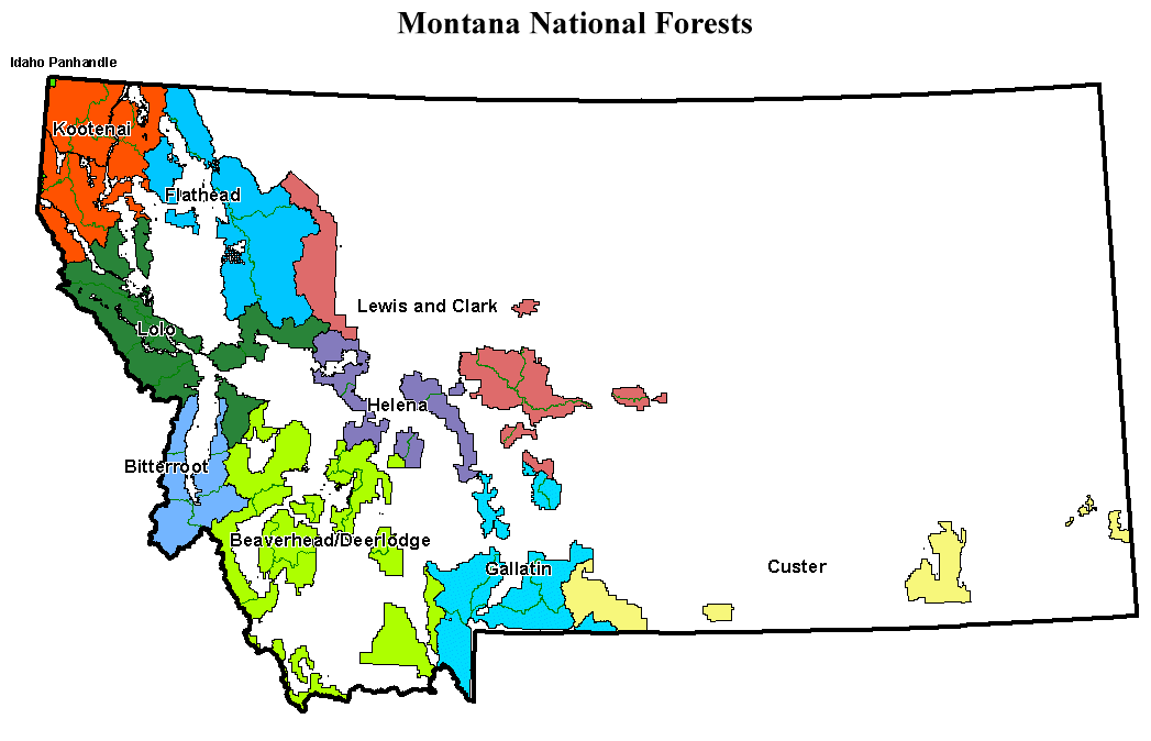
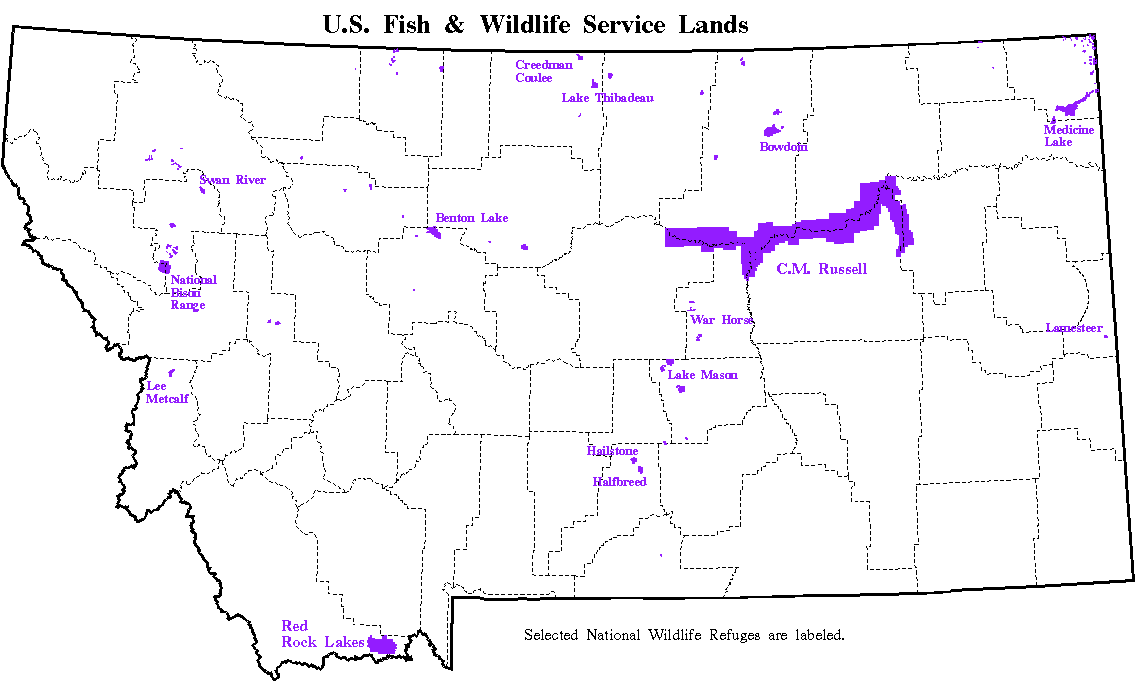
| National Forest Lands | US Fish & Wildlife Service Lands |
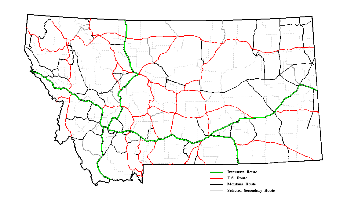
| River Basins | Highways |
This site includes information concerning Surface Water (Current Streamflow Conditions, Historical Streamflow data, and a List of Active and Discontinued Streamflow Stations), Monthly Water Conditions Report, Water-Use Information, and a Data Request form.